Shadow Diagram Information Required
The preparation of shadow diagrams requires certain information relating to heights of buildings, fences, walls and ground levels.
This information can be obtained by engaging a land surveyor that uses accurate equipment to measure heights, and also prepare plans of the subject site as well as surrounding neighbouring structures and ground levels relevant to the proposed building work.
Land Surveyor Information
he information for the heights of structures and ground levels is referred to as R.L’s (reduced level) The R.L is a vertical dimension / distance from a point determined by the person doing the survey.
Basic information required on a survey plan that is required for a shadow diagram is as follows:
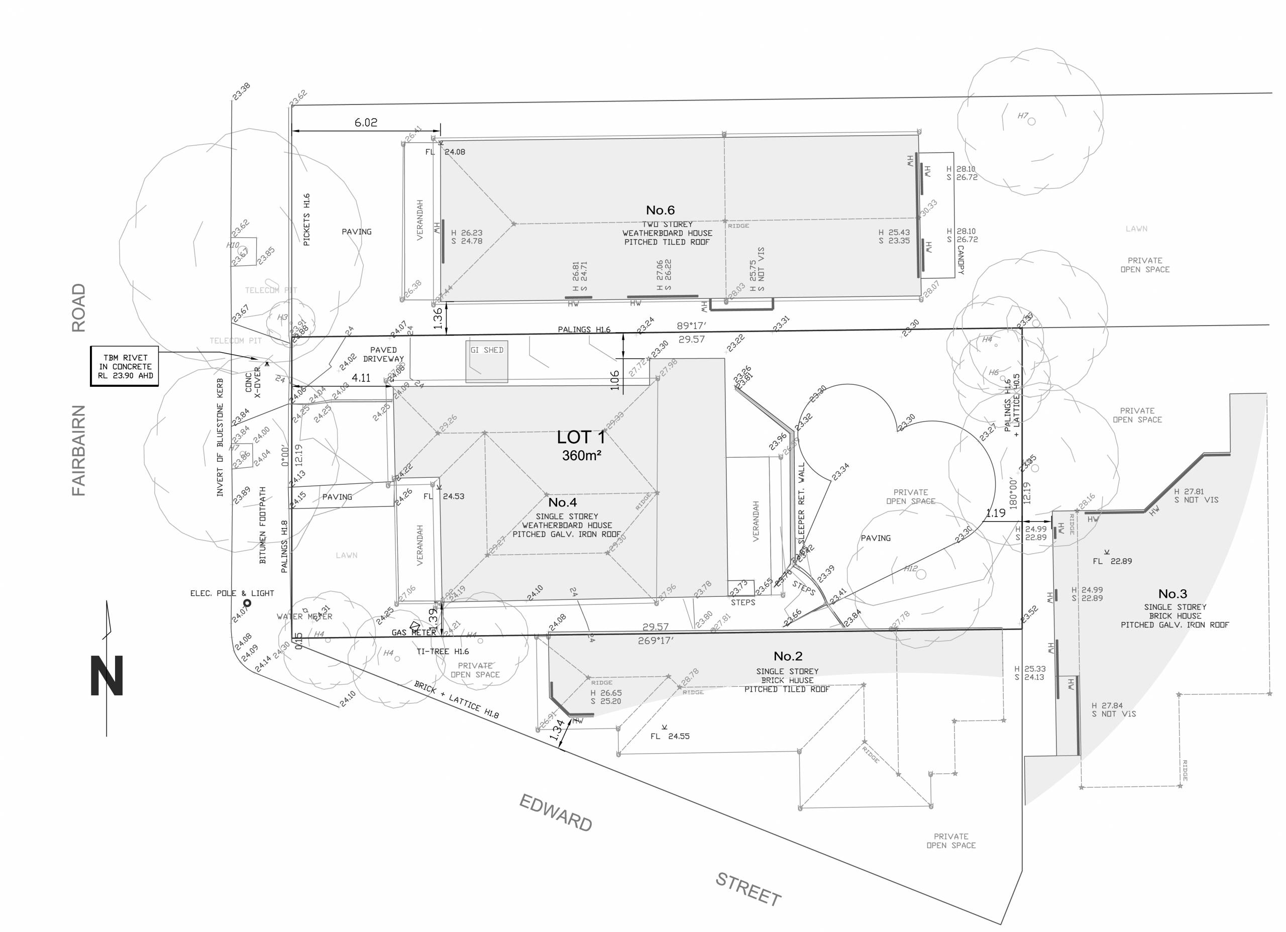
1. Building Outlines / Roof Lines (Plan showing building outlines and locations)
2. R.L Ridge Heights Existing House & Neighbouring
3. R.L Gutter Heights Existing House & Neighbouring
4. R.L Height of Sheds, Outbuildings Subject Site
5. R.L Window & Door Sill & Head Heights Neighbouring (On the drawing, shown as H = Head, and S = Sill next to windows)
6. R.L Fence/Wall Heights Boundary
7. R.L Terrace Balcony Heights – Neighbouring
8. R.L Ground Levels of Subject Site & Neighbouring Properties – Spot Levels along boundary lines, also at base of house walls
9. Indicate Windows on Plan, and if possible, note if habitable room or not (Not essential – Shown on Plan as HW = Habitable Window)
10. North Point Location (True North, not magnetic North)
11. Vegetation
[the_ad id=”2540″]
Looking at the image below, you can see an example of information required on the survey plan. Additional information is always welcome, although the list above is the most crucial information required (where applicable)